
Research
Climate and energy systems are tightly coupled: rising temperatures increase cooling demand, and waste heat can intensify urban warming. My work integrates field measurements, physics-based models, geospatial data science, and remote sensing to quantify these feedbacks and to design actionable mitigation strategies at scales from buildings to entire cities.
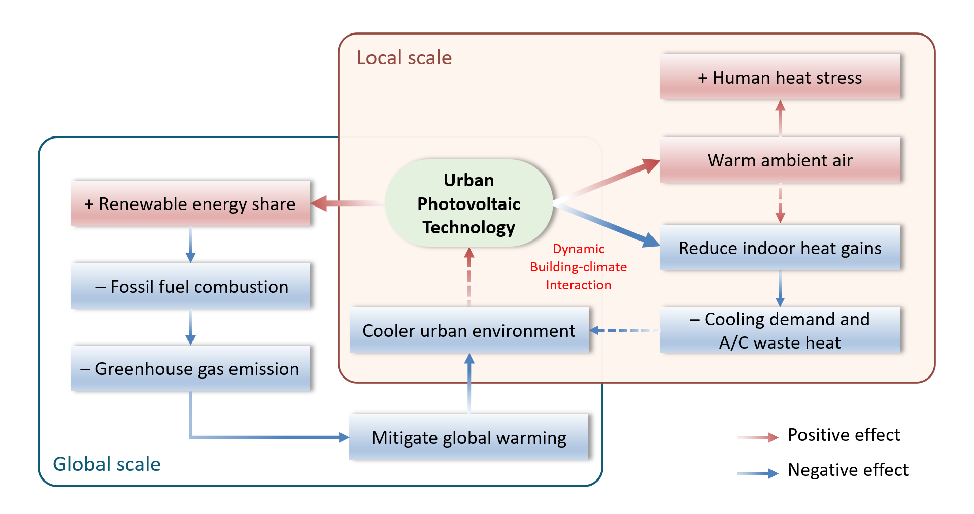 Figure 1: Photovoltaics within the urban climate-building energy feedback.
Field Experiment — Rooftop Mitigation Strategies
We conducted a full-scale experiment to test cool roofs, green options, and PV configurations. Below is a video introducing the experiment we conducted at HKUST, exploring different rooftop mitigation strategies.
Video 1. Rooftop mitigation strategies experiment
Modeling Frameworks
To analyze indoor–outdoor interactions, I couple a building energy model with a single-layer urban canopy model (BEM–SLUCM) and extend to urban-scale building energy models (UBEM) for scenario testing of PV strategies, retrofits, and materials.
 Figure 2. Urban canopy–building energy coupling.
 Figure 3. Testing retrofit measures using an urban-scale building energy model.
City-scale BIPV application: Mitigating Urban Climate–Energy Feedback with Citywide BIPV Implementation (Nexus, 2026).
Full text: https://www.cell.com/nexus/fulltext/S2950-1601(25)00061-0GeoBEM platform: GeoBEM: A geospatial computing empowered framework for urban-scale building energy modeling (Sustainable Cities and Society, 2025). DOI: https://doi.org/10.1016/j.scs.2025.106203
Curious about how buildings use energy across Hong Kong?
👉 Explore the interactive UBEM map.
Remote Sensing & Geospatial Analysis — Heat Exposure & Equity
As part of a NASA-funded study on 3D urban change and humid-heat across the Mediterranean, I am building a geospatial analytics pipeline to quantify extreme heat exposure and equality. Output: reproducible workflows and decision-ready indicators for climate adaptation and public health planning. DOI: https://iopscience.iop.org/article/10.1088/1748-9326/ae6711
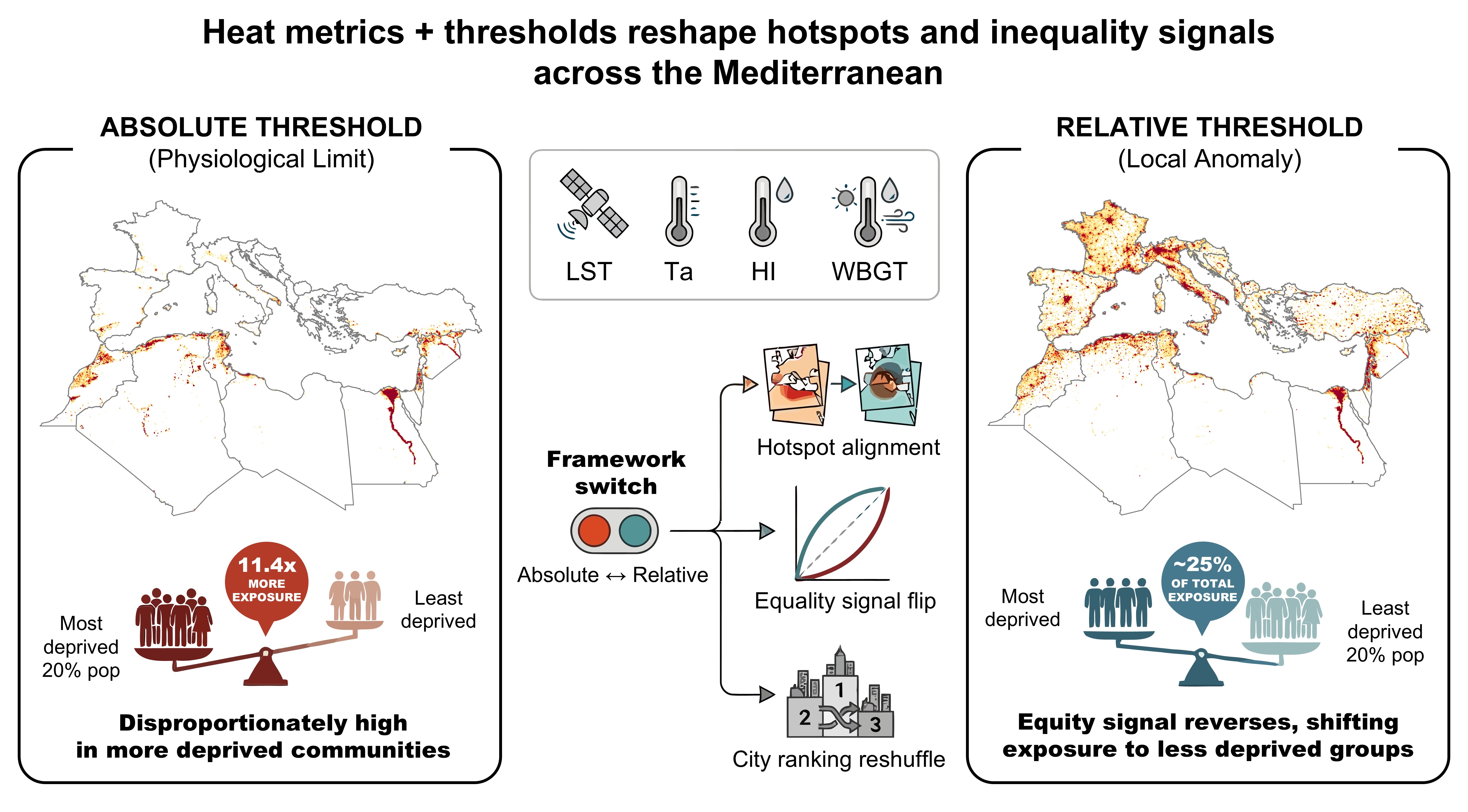 Figure 4. Heat metrics and thresholds reshape population exposure and inequality signals.